")


Description
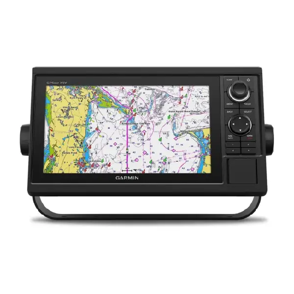
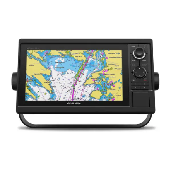
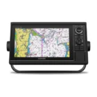
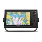
A PREMIUM CHARTPLOTTER FOR THE ADVENTUROUS SPIRIT
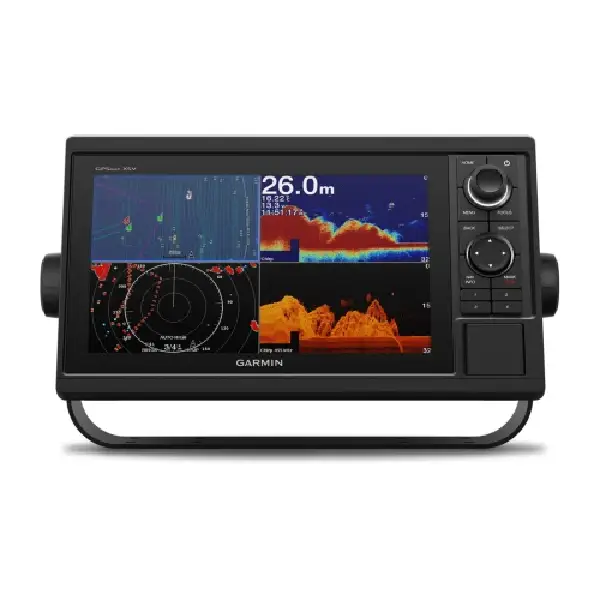
These chartplotters feature large, bright screens coupled with quick and easy-to-use keypad interfaces with user-programmable keys and multifunction control knobs to help you navigate with ease.

Get wider viewing angles on a vivid 10″ or 12″ colour display.

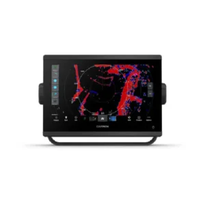
These are compatible with our premium maps and charts for the best in Garmin navigation.

Share information among multiple units, thanks to Garmin Marine Network support.

See fluid position and heading changes with update rates of 10 times per second.

Easily transfer waypoints, tracks and routes from your other GPS devices.

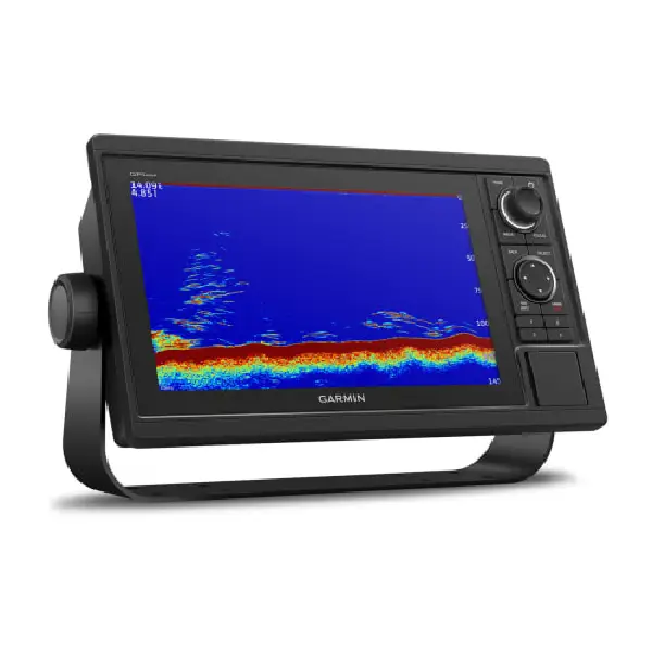
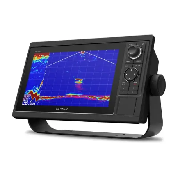
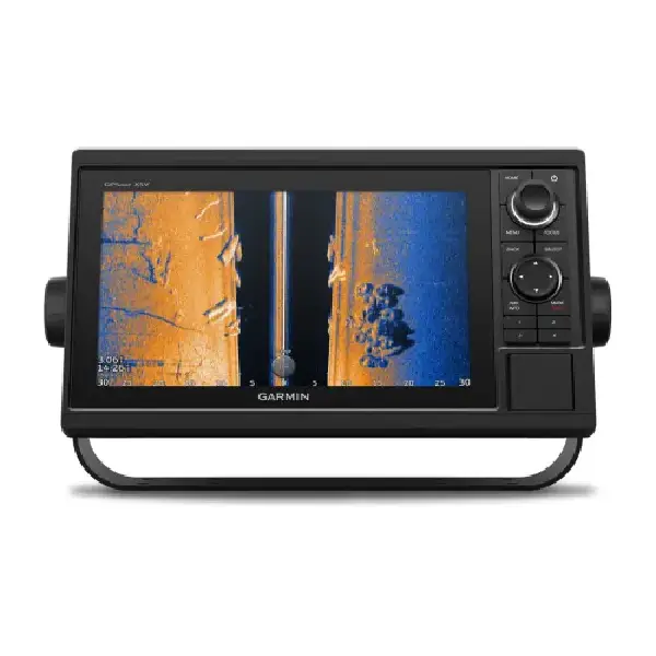
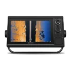
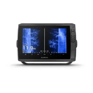
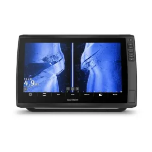
See what’s around your boat with built-in sonar capabilities on select models (transducers sold separately).
General
| DIMENSION | 12.5″ x 7.3″ x 2.7″ (318 x 185 x 69 mm) |
| WEIGHT | 4.1 lbs (1.85 kg) |
| WATER RATING | IPX7 |
| DISPLAY TYPE | WSVGA, NP |
| DISPLAY SIZE | 8.8″ x 4.9″; 10.1″ diagonal (22.4 x 12.5 cm; 25.7 cm diagonal) |
| DISPLAY RESOLUTION | 1024 x 600 pixels |
| MOUNTING OPTIONS | Bail or flush |
| Input | Keyed |
Maps & Memory
| ACCEPTS DATA CARDS | 2 SD™ cards |
| WAYPOINTS | 5,000 |
| TRACK POINTS | 50,000 |
| TRACKS | 50 saved tracks |
| NAVIGATION ROUTES | 100 |
Sensors
| GPS | ✔️ |
| GLONASS | ✔️ |
| GALILEO | ✔️ |
| HAS BUILT-IN RECEIVER | ✔️ |
| RECEIVER | 10 Hz |
| NMEA 2000 COMPATIBLE | ✔️ |
| NMEA 0183 COMPATIBLE | ✔️ |
| SUPPORTS WAAS | ✔️ |
Built-in maps
| Tide tables | ✔️ |
Optional map support
| BlueChart g3 | ✔️ |
| BlueChart g3 Vision | ✔️ |
| LakeVü g3 | ✔️ |
| LakeVü g3 Ultra | ✔️ |
| Garmin Navionics+™ | ✔️ |
| Garmin Navionics Vision+™ | ✔️ |
| TOPO 100K | ✔️ |
| Standard Mapping | ✔️ |
| Garmin Quickdraw Contours | ✔️ |
| Raster chart support | ✔️ |
Chartplotter Features
| Smart Mode Compatible | ✔️ |
| AIS | ✔️ |
| DSC | ✔️ |
| Supports Fusion-Link™ compatible radios | ✔️ |
| GSD Black Box Sonar Support | ✔️ |
| GCV Black Box Sonar Support | ✔️ |
| ActiveCaptain Mobile Planning Compatible | ✔️ |
| GRID (Garmin Remote Input Device) compatible | ✔️ |
| Wireless Remote Compatible | ✔️ |
| Sailing Features | ✔️ |
Electrical features
| POWER INPUT | 10 to 32 Vdc |
| TYPICAL CURRENT DRAW AT 12 VDC | 1.9A |
| MAXIMUM CURRENT DRAW AT 12 VDC | 2.7A |
| MAXIMUM POWER USAGE AT 10 VDC | 32.4 W |
Sonar Features
| DISPLAYS SONAR | ✔️ |
| POWER OUTPUT | 1 kW |
| TRADITIONAL SONAR (DUAL FREQUENCY/BEAM) | built-in (single channel CHIRP, 70/83/200 kHz, L, M, H CHIRP) |
| CLEARVÜ | Yes with CHIRP (built-in) |
| SIDEVÜ | Yes with CHIRP (built-in) |
| PANOPTIX™ SONAR | ✔️ |
| LIVESCOPE | ✔️ |
Connections
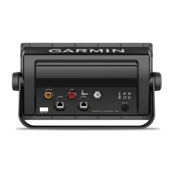
| NMEA 2000 PORTS | 1 |
| NMEA 0183 INPUT (RX) PORTS | 1 |
| NMEA 0183 OUTPUT (TX) PORTS | 1 |
| VIDEO INPUT PORTS | 1 (BNC) |
| GARMIN MARINE NETWORK PORTS | 2 |
| ANT®(CONNECTIVITY) | ✔️ |
| GARMIN WI-FI NETWORK (LOCAL CONNECTION) | ✔️ |
- GPSMAP 1022xsv chartplotter
- Power/data cable
- NMEA 2000 T-connector
- NMEA 2000 drop cable (2 m)
- 8-pin transducer to 12-pin sounder adapter cable
- Bail mount kit with knobs
- Flush mount kit with gasket
- Protective cover
- Trim piece snap covers
- Documentation


There are no reviews yet.